Introduction to Machine Learning and its Usage in Remote Sensing

What Is A Geosynchronous Satellite And How Is It Different From A Geostationary Satellite?

<br>Comparing Machine Learning as a Service: Amazon, Microsoft Azure, Google Cloud AI, IBM Watson
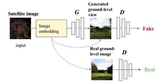
Given a satellite image, machine learning creates the view on the ground
Fast-track Geospatial AI Applications with Watson Data Platform and Esri ArcGIS

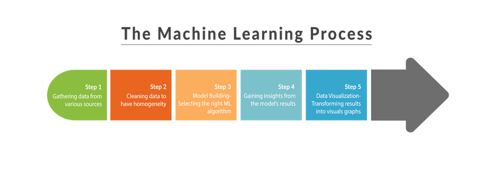
Machine Learning Algorithms You need to Know
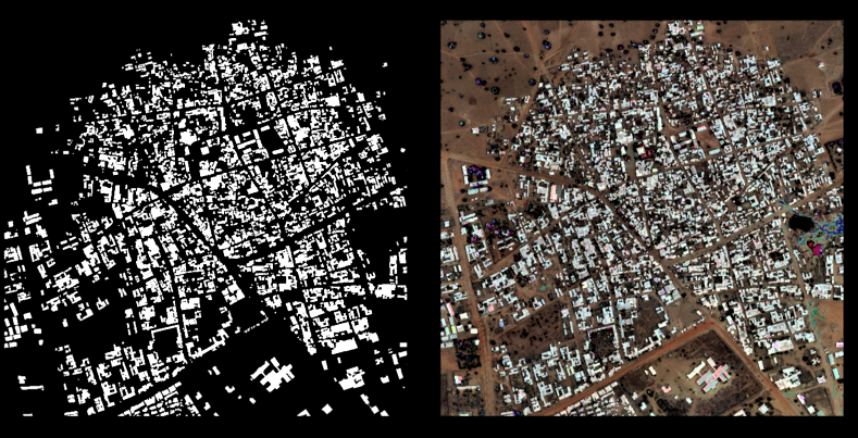
Neural network for satellite image segmentation
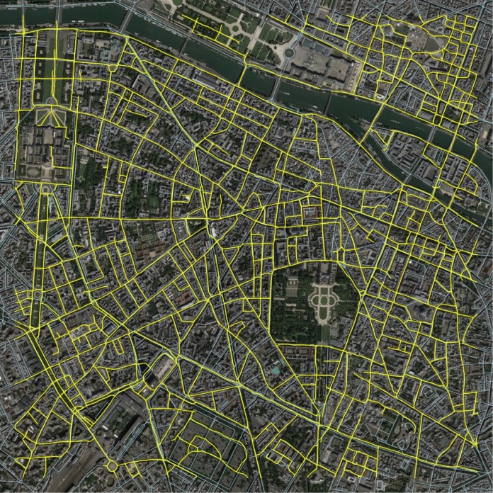
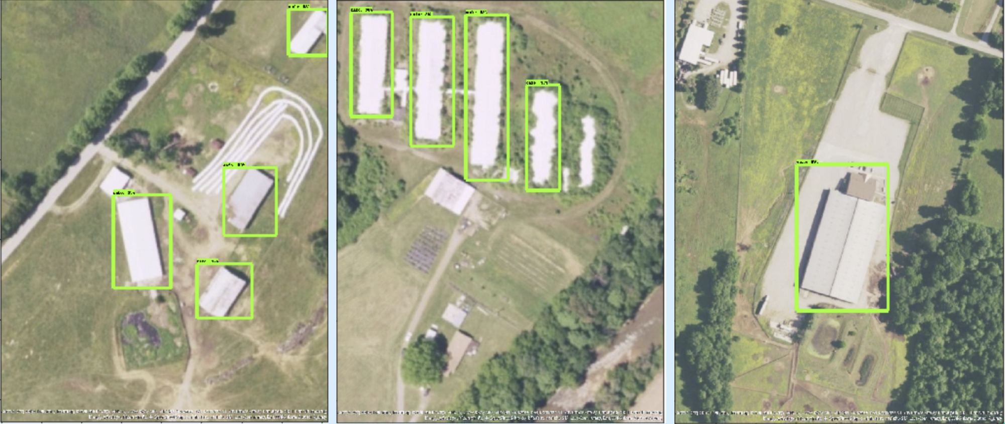
Map roads more efficiently than Google? This new AI engine can!
Newcomers Earth Observation Guide